Virtual Sardinia: A Large-Scale Hypermedia Regional Information System

Enrico Gobbetti (1)(2) and Andrea O. Leone (3)

(1) UMBC, CSEE Dept., Baltimore, MD, USA
(2) CESDIS , NASA GSFC, Greenbelt, MD, USA
(3) CRS4 , Via Sauro 10, 09123 Cagliari, Italy

E-mail: gobbetti@cs.umbc.edu, cirio@crs4.it

Goals and Motivation

  • Collect information on the Island of Sardinia
  • Geographic/archaeological data, historical/touristical information
  • Heterogeneous information sources
  • Make information available to a large number of people
  • Facilitate studies
  • Promote Sardinia resources
  • Approach

  • Data gathering and database creation
  • World-Wide Web to combine heterogeneous distributed databases
  • Development of specialized visualization/navigation tools integrated in a Web framework
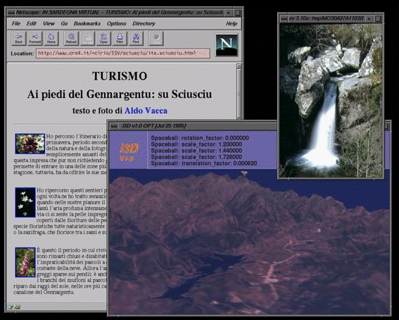
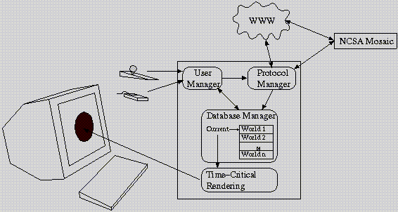
  • Accessing Information

  • Cross-referencing through hyperlinks
  • Multiple indexes and search engines
  • Emphasis on georeferenced data
  • Terrain visualization
  • Hyperlinks on the terrain
  • Why Georeferenced Data?

  • Easily readable maps with markers
  • The terrain model becomes an index
  • Useful with cross references to and from other data sources
  • Natural complement to other search techniques
  • 2D terrain

    Why 3D Navigation?

  • The terrain shape is a source of information in itself!
  • Habitat and landscape boundaries have simpler connotations
  • Interactive exploration of a 3D model allows users to discover features not easily detectable using traditional 2D cartographic representations
  • 2D operation (pan/zoom) can be obtained naturally in 3D by constraining the camera motion
  • 3D terrain

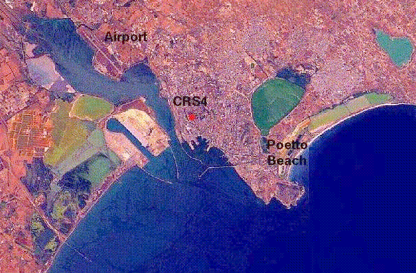
    Virtual Sardinia Overall View

    Overall view

    Making 3D Navigation Possible and Practical

  • Create a 3D model from satellite images and elevation data
  • Annotate the 3D model with markers referring to other documents
  • Use an interactive 3D viewer to explore the model
  • Original Terrain Model

  • Color: Landsat scene, 5279 x 10881 pixels, bands 3 2 1 (RGB) [30 m resolution resampled to 25 m]
  • Elevation: 359x681 regular grid [400 m resolution]
  • Much too big for interactive exploration
  • Brute-force rendering would require 500K triangles/frame
  • Impossible to meet latency and visual feedback constraints even with high-end machines
  • At least ten frames per second required to give the illusion of smooth motion
  • Need for data reduction and multiresolution viewing
  • Multiresolution Terrain Model

  • Texture-mapping of image onto elevation grid
  • Subdivision of the model into 16x10 quadrants that can be handled independently
  • Image simplification
  • Resizing to fit into machine texture memory
  • Geometry simplification
  • Regular grid converted to irregular triangle net
  • Three levels of detail (LOD) per quadrant created by triangle decimation
  • Entire Model complexity: 41987-108617 triangles
  • Automatic trading of quality/speed at rendering time speed
  • Hyperlinks from each quadrant to a high resolution version of the surrounding region
  • User-controlled quality increase
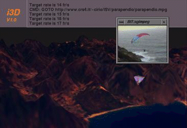
  • i3D: High-Speed VRML Browser

  • VRML-1.0 compatible
  • Continuous 6 DOF camera motion control using a Spaceball
  • Stereo on workstation monitor/projection screen using Stereographics CrystalEyes
  • Time-critical rendering to support navigation in very large scenes
  • i3D Diagram

    i3D: Time-Critical Rendering

  • Adaptive trading of rendering quality with speed
  • Hierarchical culling based on octree spatial subdivision
  • Per object level of detail selection based on relative object importance, computed using projected size on screen
  • Feedback algorithm adjusts LOD selection algorithm parameters to meet timing constraints
  • Per object update rates used to exploit frame coherency and reduce per-frame computation
  • Very large databases can be rendered at interactive speeds
  • Performance comparable to high-end VR systems
  • Alternative 3D Navigation Tools
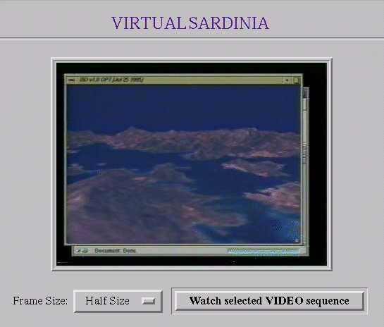
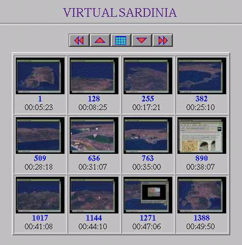
  • Weblive - distribution of prerecorded sequences
  • Webshow - frame indexing for sequence selection
  • Overall view Overall view

    Demonstration Video

  • Recorded live on a Silicon Graphics Onyx RE2.
  • Interactive sessions were not edited (except for elimination of network latencies).
  • Conclusions

  • Interactive 3D viewer used as a front end to query information about georeferenced data
  • A useful complement, not a replacement of other search techniques
  • Possible to interactively explore large terrain models
  • Bottleneck is data transfert, not graphics performance
  • Principal Future Works

  • Better integration among different components
  • Thematic navigation and guided tours
  • 3D animation and simulation (evolution of terrain in time)
  • Specialized terrain visualization tools
  • GIS features and route planning
  • Data reduction for network transfert
  • Extended availability to the internet community
  • Availability

  • Virtual Sardinia available on the internet at the address http://www.crs4.it/PRJ/VIRTSARD/
  • Work in progress: stay tuned!
  • i3D available on the internet at the address http://sgvenus.cern.ch/i3d/
  • Work continued at CERN by the VENUS group
  • Acknowledgments

  • Research and development carried out at the Center for Research, Development, and Advanced Studies in Sardinia (CRS4), Cagliari, Italy
  • Satellite and elevation data provided by the Earth Sciences Department of the University of Cagliari, Italy
  • Financial support of the Sardinian Regional Authorities